Sunday, May 17, 2009

ASOS AND AWOS

ASOS AND AWOS
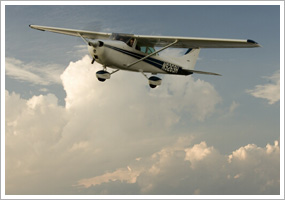
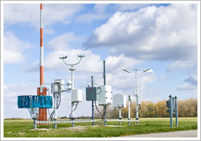
Technology has brought an enormous increase in the amount of information—especially weather information—at a pilot's fingertips. During the preflight briefing, you can study conditions at multiple reporting points, thanks to automated surface observation systems (ASOSs) and automated weather observation systems (AWOSs) at many airports. And those same systems are there to help you plan your arrival at many destinations. Include monitoring the station's report on your list of arrival duties before you contact the tower or request an airport advisory at nontowered airports.

"Each ASOS is equipped to transmit weather via voice or computer through telephone or on VHF radio frequencies," Use the Safety Advisor to learn the different service levels of the various ASOS installations—and consider the circumstances under which the information provided is susceptible to inaccuracy or error. You'll also see an explanation of the differences between ASOS and AWOS installations. ASOS is more sophisticated, uses more computer processing, and has better quality control. Note that if a component of an ASOS's weather reporting capabilities is not operating, a code to that effect will appear in its published METAR. For instance, the code TSNO indicates that thunderstorm information is not available—definitely worth knowing during your preflight briefing.

Want to start watching weather trends at a possible destination, or just curious about what's happening at your home airport? Visit this FAA's ASOS Web page to check conditions.

With ASOS information so easily obtainable in a preflight weather briefing by telephone or computer, and from the air by radio, there's no reason not to acquire the most timely reports, then update as you near your destination [see your VFR aeronautical chart, AOPA's Airport Directory, or the Airport/Facility Directory for the correct frequency].

SHARING YOUR AIRSPACE


You have learned the correct method for safely entering the traffic pattern at nontowered airports, and you've studied right-of-way rules that keep different categories of aircraft safely separate. (See the May 2, 2003, "Training Tips" on right-of-way rules.) Now you're ready to put these concepts to the test as you endeavor to operate safely in the presence of other airport users.

After you check airport publications for your destinations' radio frequencies, runway lengths and bearings, and facilities, be sure to look up what other kinds of air traffic might be present. "To airplane pilots, the ways of helicopters, gliders, and balloons seem mysterious. Knowing how they come and go helps you to coordinate your departures and arrivals with theirs. Being familiar with their operation is comforting when you scan for traffic because you know where to look for them.

Towplanes and gliders may use only the runway that is closest to the glider operation's base; you may need to use another because of reported surface winds. Large airplanes may use only the longer runways and fly a higher traffic pattern. Parachute jumping could be under way; what frequency is used to advise local aircraft about "jumpers away"? Helicopter pilots are responsible for avoiding the flow of fixed-wing aircraft, but keep an eye out for them in the pattern and while taxiing. Instrument approaches flown for practice by pilots training for the instrument rating could be in progress. These aircraft train with different arrival routes than aircraft making routine arrivals under visual flight rules. Ask your instructor to describe instrument training that could be in progress and what to listen for on the common traffic advisory frequency (CTAF). If there is a floatplane base on an adjacent body of water such as a river or lake, visualize its traffic pattern. Does the seaplane base use the same CTAF as the airport?

Experience will make these other kinds of aviation activity more familiar. Meanwhile, do your research and ask questions to fill in the gaps.

FLAPS: WHEN AND WHY


Most student pilots train in aircraft equipped with flaps. In the traffic pattern, the flaps are typically deployed gradually, starting abeam the runway numbers and ending with full deployment on final approach. Many students ask: Why not deploy the flaps all at once?

"Large flap deflections at one single point in the landing pattern produce large lift changes that require significant pitch and power changes in order to maintain airspeed and descent angle. Consequently, the deflection of flaps at certain points in the landing pattern has definite advantages. Incremental deflection of flaps on downwind, base leg, and final approach allow smaller adjustment of pitch and power compared to extension of full flaps all at one time," explains Chapter 8 of the Airplane Flying Handbook.

"When teaching landings in a Cessna or Piper training aircraft, I have the student use one notch of flaps and trim when abeam the numbers. From here, the remaining flaps are used to adjust the aircraft's descent to the touchdown point. If the pattern is a normal-sized pattern (the turn from base to final will be slightly more than a quarter-mile from the runway), and the headwinds on final are light, the second notch of flaps will be applied when they are needed to keep from landing long. This typically occurs just before turning from base to final. The third and last notch of flaps is applied when the landing is assured."

But don't let that comfortable routine make you complacent. Unusual winds, extending your downwind leg for spacing, or getting instructions from the tower to "make short approach" may call for other techniques (and don't forget to perform some no-flap landings).

During dual sessions of airwork, it will help if you spend some time practicing holding heading and altitude at approach airspeeds while changing flap configurations—full flaps, no flaps, and everything in between—to learn the aircraft's responses and the power-pitch inputs required. With some practice, you'll be ready for whatever kind of landing is called for next!

WHAT'S THE CEILING?

WHAT'S THE CEILING?
When it comes time for you to fly solo, your instructor will note limiting weather conditions for your flights in your logbook. One limit likely will be the lowest ceiling under which you are permitted to solo. Another may be a minimum visibility value. [See the Jan. 27, 2006, Training Tip "Solo Limitations."]

Not all cloud cover represents a ceiling. It depends on how much of the sky is visible. The definitions used to describe sky cover carry inferences as to whether a ceiling exists. "A ceiling, for aviation purposes, is the lowest layer of clouds reported as being broken or overcast, or the vertical visibility into an obscuration like fog or haze. Clouds are reported as broken when five-eighths to seven-eighths of the sky is covered with clouds. Overcast means the entire sky is covered with clouds," explains chapter 10, page 17 of the Pilot's Handbook of Aeronautical Knowledge.

You'll find current sky conditions in aviation routine weather reports (METARs) and many automated observations. Sky cover reported as less than broken (few clouds, or scattered layers) does not constitute a ceiling. See the table of contractions on chapter 11, page 6 of the handbook for sky cover, represented in eighths (octas) of the sky from horizon to horizon, for each description.

Why octas? "Students frequently ask why sky cover and obscurations are reported in octas rather than tenths. The four cardinal points of the compass (N, E, W, S) and the four intercardinal points (NE, NW, SE, SW) divide the compass into eight sectors. Cloud cover and obscurations are easy to evaluate if you observe the conditions that exist in each of the eight sectors and base your report on how many sectors that condition occupies. Sky cover is also an element in pilot reports (pireps).

On nonflying days, practice estimating sky cover and comparing your conclusions with aviation weather reports. Also check out the AOPA Air Safety Foundation's online course "Weather Wise: Ceilings and Visibility" to further sharpen your skills.

HEAVY AIRCRAFT


A sample question from the private pilot knowledge test question bank asks: "When departing behind a heavy aircraft, the pilot should avoid wake turbulence by maneuvering the aircraft

A) below and downwind from the heavy aircraft.

B) above and upwind from the heavy aircraft.

C) below and upwind from the heavy aircraft.

When clearing you for takeoff or landing, the tower controller may add to your clearance the phrase "Caution wake turbulence" from the preceding arrival or departure. Although it may seem obvious to the pilot of a single-engine trainer that the preceding aircraft is heavy, the use of the term has special significance, as explained in Chapter 7 of the Aeronautical Information Manual (AIM): "For purposes of Wake Turbulence Separation Minima, ATC classifies aircraft as Heavy, Large, and Small as follows: Heavy—Aircraft capable of takeoff weights of more than 255,000 pounds whether or not they are operating at this weight during a particular phase of flight. Large—Aircraft of more than 41,000 pounds maximum certificated takeoff weight, up to 255,000 pounds. Small—Aircraft of 41,000 pounds or less maximum certificated takeoff weight."

Considering those definitions, the AIM describes aircraft separation requirements: "Because of the possible effects of wake turbulence, controllers are required to apply no less than specified minimum separation for aircraft operating behind a heavy jet and, in certain instances, behind large nonheavy aircraft (i.e., B757 aircraft)," as Elizabeth A. Tennyson explains in the AOPA Flight Training May 2001 column "Aviation Speak: Heavy."

If you find yourself facing wake turbulence on departure, you may choose to ask the tower to approve an early turn (upwind of the wake's probable drift track) when altitude permits after takeoff. Make this request when you contact the tower for your takeoff clearance. Don't wait until you are airborne, when traffic concerns or frequency congestion can delay approval.

Stay alert to hearing the word heavy on the ATC frequency!

"Pilot or Operator?"

"Pilot or Operator?"
It's my latest obsession. Pilots using GPS and using it wrong. I've been on a mission for the last few newsletters to try to give reasons on how to use GPS correctly and not let it become your only form of navigation. So here's my latest installment and it's one that I think drives the point home.
When you think about using a GPS in a car that same logic doesn't carry through to an airplane. For example, if you set the address wrong you'll just go to the wrong place and probably nothing else will happen. Maybe the database isn't 100 percent correct and you take a turn to a dead end. Again, probably nothing bad will happen. You set where you want to go in the GPS and you "allow" it to take you there. You can eliminate all sense of direction if you want and just follow the voice commands from the GPS. You are an operator of the GPS and really you don't need to know anything else about how it works or the errors it may have or really much of anything else. If the GPS makes a mistake, or you do, the consequences aren't that bad. It's a time penalty and that's about it. So you can truly just be an operator of the GPS and get by just fine.
GPS in aircraft are different than GPS in your car. The consequences of making an error using the GPS are higher and because the GPS is not just going to an address, gas station or following a single road etc. there are many more choices of flight plan routes to consider. The car only has a few choices, we have many more.
Terrain, what to do if the engine fails over this area or that, weather, choice of airports for fuel stops etc. are all extra things to consider when we use an airplane GPS that don't exist when we use the car GPS. It's important to be a pilot first and a GPS Operator second. We must use our judgement when selecting routes, airports etc. without just letting the GPS do it for us. Why? Because in an airplane you don't want to be just an operator because the consequences are too high. When we allow the GPS to tell us where we are and where we are going we become operators and we are no longer pilots.
So how do we fix this? Well to start we challenge ourselves to know where we are first then let the GPS confirm that we are in fact there. We ALWAYS use a different form of navigation other than GPS to back up data that the GPS is giving to us. We begin thinking that the sky is one big canvas that we can navigate in any way we choose and not as a series of IFR airways and intersection to intersection flight planned GPS routes or VP this or that. When we begin using the GPS as a pilot first we allow ourselves to consider all possibilities and not just the pink line. IFR Flying is a slightly different story as there may only be GPS data available.
So in summary, learn to tell the GPS where you are, then affirm the GPS is where you know it to be. A last thought is that GPS can be a powerful tool to help you navigate to a nearest airport in case of trouble or to take a more direct route.
Use the GPS as an aid in navigation and it will be yet another powerful tool for you to select to use as a pilot, not one you MUST use. This simple approach will help take you from an Operator to a Pilot.

CLOUD TOPS


When you call for a preflight weather briefing, information about the height of cloud bases and the extent of cloud cover helps you make your go/no-go decision.

What about cloud tops? Flying above cloud layers is not routine for student pilots—and the federal aviation regulations prohibit it "when the flight cannot be made with visual reference to the surface." Yet many pilots hoping for a complete weather picture ask how to find information about cloud tops.

"But that's precisely the problem. For all the meteorological advances in recent decades, apparently very little effort has been put into technologies that could help us in this regard. So for the near future, anyway, we're left to rely on just a few sources of information about tops," including area forecasts, radar summary charts, satellite imagery, atmospheric soundings, and pilot reports (pireps).

An area forecast (FA) is the most familiar of these resources. Cloud top information found in the fourth section of an FA is general. That's because the FA "gives a picture of clouds, general weather conditions, and visual meteorological conditions (VMC) expected over a large area encompassing several states," explains Chapter 10 of the Pilot's Handbook of Aeronautical Knowledge.

Pireps help, but Horne offered this reminder: "Pireps promise the most accuracy, but please check the dates and times of any pireps. It's not unusual for pireps to be a day old, yet still be posted. The problem with pireps is that most pilots never make them, so we are deprived of good cloud-top information by some of the best weather observers in the world."

Why is flying VFR above clouds discouraged for the inexperienced pilot? One risk is becoming trapped above a scattered or broken cloud cover that unexpectedly closes up to solid overcast. But even when breaks remain, pilots have encountered spatial disorientation and lost control during descent, as documented in this accident analysis. Steering well clear of all clouds remains the best bet.

'MAINTAIN VFR'


Two recent Training Tips discussed cloud cover ("What's the ceiling?" and "Cloud Tops"). Those clouds in the distance off your wing tip must be given wide berth, too. One day you might receive a clearance to enter or depart controlled airspace accompanied by the cautionary instruction, "Maintain VFR at all times." Why did the controller say that?

The caution was meant to remind you that you, as the pilot, should never let a radar vector or other instruction get you in trouble. "In many cases, particularly at radar facilities, the people on the ground have little idea of the flight conditions beyond what has been relayed by pilots," wrote Bruce Landsberg, executive director of the AOPA Air Safety Foundation, in the safety article "Just say 'unable.'" This isn't a concern only for instrument pilots trying to comply with instructions while avoiding turbulence or icy clouds. "A similar situation involving benign clouds can develop with a VFR pilot operating in Class B or C airspace. Pilots not on an IFR flight plan are expected to maintain VFR—period. If an assigned heading or altitude is going to put the airplane too close to a cloud, then advise the controller that you are 'unable to maintain VFR' and suggest an alternative heading or altitude."

Some experience flying nearer than is comfortable to clouds, in the company of your instructor, will eliminate any skepticism you may have about the importance of this responsibility. Horne argues that gradual exposure to poorer weather conditions should be included in any comprehensive flight training. "I've always been an advocate for flight instructors taking primary students on flights in marginal VFR weather—both in the traffic pattern and away from it. This way, the student can see what a 1,000-foot ceiling and three-statute-mile visibility (the VFR weather minimums at airports with controlled airspace designated to the surface) looks like. The same goes for flights at altitude, flying in three-mile visibilities and trying to keep the prescribed distance from clouds. The student quickly learns that three miles isn't much visibility at all."

Even when there's no controller reminding you to maintain VFR, remember those wise words. They'll keep you safe!

'POSITIVE' CONTROL


Most pilots spend most of their flying time operating in controlled airspace. But for the different classes of controlled airspace, there are varying degrees of control. The largest swath of controlled airspace isn't controlled beyond your obligation to observe weather requirements for VFR flight within its boundaries.

The basic differences can be summed up in the term "positive control." As defined in the Pilot/Controller Glossary of the Aeronautical Information Manual, positive control "means control of all air traffic, within designated airspace, by air traffic control."

Class A airspace, starting at 18,000 feet, is an example. Entry requires a clearance under instrument flight rules from ATC. Before airspace was classified by letters, Class A airspace was known as the positive control area. Pilots operate under positive control in Class B airspace, surrounding the busiest airports. You may not enter Class B airspace without a specific clearance from ATC. "Class B airspace provides for positive control of both VFR and IFR traffic.

Class C airspace, surface-based and centered on a towered airport with radar service, requires that communications be established, but specific clearance into the airspace is not required. In Class D airspace, centered on an airport with an operating control tower, there is also a requirement to establish two-way communications. The airspace reverts to Class E when the tower is not operating [Class G if weather information is not available].

In the vast reaches of Class E airspace a pilot may fly with no ATC interaction—provided the appropriate weather requirements for VFR flight are satisfied. However, it is recommended that pilots make use of radar flight following when and where it is available. And nowadays it is prudent to check notams for temporary flight restrictions along any route.

Positive control can require different procedures for different kinds of flights in airspace such as the Washington Air Defense Identification Zone (ADIZ).

CLIMBING, COOLING, CLEARING

CLIMBING, COOLING, CLEARING
What's the description of a well-executed climb to altitude after takeoff? Setting up the aircraft at the airspeed that delivers the desired rate of climb (Vx or Vy) is the first goal. Trimming the aircraft to maintain the climb airspeed comes next. But is that all there is to it?

Not exactly. In a climb to cruise altitude, collision avoidance and the efficient management of your aircraft's engine also demand attention. The designated pilot examiner who will conduct your flight at checkride time will want to see that you have the big picture in mind.

When climbing after takeoff, especially during warm weather, monitor your oil-temperature gauge for any signs of engine overheating. The design of an air-cooled engine (the type installed in most general aviation aircraft) "is less effective during ground operations, takeoffs, go-arounds, and other periods of high-power, low-airspeed operations," explains Chapter 5 of the Pilot's Handbook of Aeronautical Knowledge. The solution: "High engine temperatures can be decreased by increasing the airspeed and/or decreasing the power."

If the pilot's operating handbook for your trainer calls for full-power climbs, lower the nose and climb at a higher airspeed, once safely above obstructions. You should also consider leaning the fuel-air mixture.

Collision risks are elevated during climb because the nose-up climb attitude of the aircraft curtails forward visibility. In an extended climb, lower the nose at regular intervals and scan the airspace ahead. Accompany these clearing maneuvers by performing gentle, coordinated banks left and right so you can scan zones obscured by the wings. Also remember blind spots created by a high glareshield or other aircraft design features, as discussed in the AOPA Air Safety Foundation's Collision Avoidance Safety Advisor.

Clearly, there's more to a good climb than just holding the correct airspeed!

Relative Wind

RELATIVE WIND
It doesn't take long for a student pilot studying basic aerodynamics to come upon a term so fundamental to piloting that understanding it unlocks the door to understanding many advanced principles of flight. The term is relative wind.

The glossary of the Pilot's Handbook of Aeronautical Knowledge defines relative wind as "the direction of the airflow with respect to the wing. If a wing moves forward horizontally, the relative wind moves backward horizontally. Relative wind is parallel to and opposite the flightpath of the airplane."

Sounds simple enough, but there are nuances. To visualize relative wind, you must understand the flight path of the aircraft. "As students, pilots learn that relative wind occurs opposite the direction of flight. That is not to be confused with the direction the nose is pointing.

Note that the safety advisor's illustration demonstrates how relative wind is used to diagram the aircraft's angle of attack—the source of lift. "Wings are able to create lift by accelerating air over their top surfaces, which are curved expressly for that purpose. As the oncoming air—called the relative wind—strikes a wing's leading edge, it splits and travels aft until meeting again at the trailing edge. The airfoil's curve guarantees that the air flowing over the top surface travels faster than the air passing beneath the wing.

Grasping relative wind is a simple step that will simplify your introduction to aerodynamics.

THE 'E' WORD

Training Ti

Nobody wants to face an emergency while piloting an aircraft. But learning to fly requires studying and practicing how to respond if things go wrong. Rule One is always: Fly the airplane! Then, activate the appropriate emergency procedure or checklist from your pilot's operating handbook. Another decision is what assistance to request from air traffic control.

When a pilot declares an emergency, he or she is granted authority to deviate from rules and clearances to the extent required to meet that emergency. That's a big responsibility, and a pilot could be called upon later to justify the actions taken. Your knowledge of emergency authority is probed in questions on the private pilot knowledge test. Here is a sample question:

What action, if any, is appropriate if the pilot deviates from an ATC instruction during an emergency and is given priority?

A) Take no special action since you are pilot in command.

B) File a detailed report within 48 hours to the chief of the appropriate ATC facility, if requested.

C) File a report to the FAA administrator, as soon as possible.

Distress is defined as 'a condition of being threatened by serious and/or imminent danger and of requiring immediate assistance.' And, urgency is defined as 'a condition of being concerned about safety and of requiring timely but not immediate assistance; a potential distress condition.' This is a good starting point to help you determine whether or not a specific situation is an emergency," Yodice wrote, adding, "The FAA further advises that an aircraft is in at least an urgency condition the moment the pilot 'becomes doubtful about' position, fuel endurance, weather, or any other condition that could adversely affect flight safety."


"Attitudes of Flight"

During your flight training you should have been introduced to attitude flying. That is, you should have learned that a certain attitude and power setting will give you a certain performance. Whether it's a climb at a particular rate, a cruise speed or whatever the lesson should be clear. Setting an attitude along with a power setting will give you something fairly predictable.
I've been noticing that some pilots will place the airplane in a very steep up or down pitch attitude chasing an airspeed or deviation in altitude. The attitude they have selected is not possible to maintain before either a stall occurs or on the other nose down case we are into the yellow arc. Pilot's who aren't aware of the "Attitudes of Flight" typically are not smooth in their control inputs because they are bracketing airspeed, altitude etc. without knowing what the end limits are. For example, if you didn't know much about flying and I told you to climb at an airspeed of 60 knots in a Cessna 172 you might start pulling back on the control wheel. This would definitely cause the airspeed to go down. If we started this from cruise flight at say 120 knots you may just keep pulling on the control wheel until the airplane became vertical. You'd get 60 knots alright, but soon you'd be stalled because the attitude and power setting were not possible to sustain. In the case of the pilot who understands the attitudes of flight, that pilot would raise the nose of the airplane to a predetermined attitude and apply power. The airspeed would begin to decrease and eventually settle near 60 knots in a sustainable attitude.
I find that pilots who use EFIS (Glass Cockpits) are the most likely not to understand the attitudes of flight. This is because the big display screams "stare at me", as it's really quite a colorful and interesting thing to look at. I mean that nicely. I think the G1000 is very cool to look at. Not stare at, but look at.
Anyway, the fix for all of this is to fly without the use of attitude indicators and EFIS for a while. Develop a sense for what attitudes are sustainable and desirable for the main realms of flight you mostly do...climbs, descents, cruise, etc. You'll not only smooth out your flying, you'll also see an unusual attitude coming way before it gets out of hand....

THE ACTIVE RUNWAY

THE ACTIVE RUNWAY
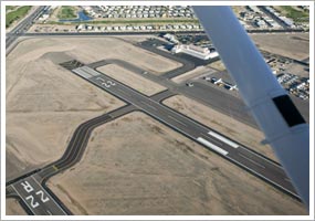
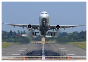
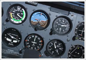
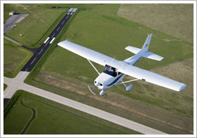
Whether heading out to fly, or returning to land, one bit of information every pilot needs is an answer to the question, "What's the active runway?" At towered airports you'll get the answer on the automated weather recording or when ATC replies to your call-up with instructions: "Taxi to Runway 33." At nontowered airports, procedures are less formal, but usually the correct course of action is clear. Automated weather will provide surface winds. The fixed-base operator may respond to your request for an airport advisory with runway information. Or monitoring the common traffic advisory frequency may reveal which runway is "active."

Occasionally the runway in use seems badly matched to the winds. It could be that a student pilot is getting a lesson in crosswinds. Or a large aircraft may opt to use the longest runway available. Now you have a decision to make. "Remember, this is a nontowered airport. The fixed-base operator providing you with active-runway information is not an air traffic controller and cannot require you to land on a runway that you consider inappropriate, if, for example, winds favor another," explained the Sept. 16, 2005, "Training Tip: Airport Advisory."

Scenarios like that are common. "Whenever a student asks me what the active runway is, my response is to shrug my shoulders and reply, 'I don't know, you're the one landing the airplane, not me. If it were my landing to do I would probably pick the runway with the most favorable wind conditions," said one flight instructor in "Instructor Reports: Pattern Operations Revisited." The article also discusses the provocative case of a business jet and a single-engine training airplane seeking to use opposite ends of the same runway, a situation that raised challenging questions for all pilots.

What if the winds are calm? Then the runway choice is yours—in most cases. Prepare to fly by always checking AOPA's Airport Directory for any special procedures, such as this requirement in effect at Bar Harbor, Maine (BHB): "durg VFR conds when wind speed is less than 5 knots as rprtd by AWOS or UNICOM; all acft using ry 4-22 shall tkof & lnd ry 22."

If there's an active runway, make sure it is also the correct runway to use.

"Hold Short - What pilot's are doing Wrong"

"Hold Short - What pilot's are doing Wrong"
In the image on the right you can see what all pilot's know. It's the hold short lines that are pavement markings at entry points to a runway.
The two solid lines facing away from the runway mean that an Air Traffic Control (ATC) Clearance is required before crossing them.
The two dashed lines on the runway side of the hold short lines mean that the pilot does not need an ATC clearance to cross them this way.
Now what I've said above is probably not news to any pilot or student pilot but what comes next may be real news to you.
I've been noticing that some pilots taxi up to the hold short lines and stop with the propeller just behind the two yellow lines. If they are taxiing straight up to the hold short line 90 degrees to the runway this usually doesn't cause a problem.
The problem occurs when the pilot is taxiing from a parallel taxiway and approaches the hold short lines from the side. In this case if the pilot turns toward the runway on the taxiway centerline and places the propeller close to the hold short lines then the wing will be over the hold short lines.
It's critical to know that no part of the airplane can be over the hold short lines.
If this happens then the controller will report a pilot deviation to the local FAA office for further investigation of the pilot and his/her training. This means at a minimum a telephone interview and counseling with an FAA inspector. In a fair number of cases the pilot is re evaluated (Takes a checkride with an inspector) for the pilot certificate he/she holds or the pilot certificate is suspended until the retest is done.
I've noticed this happening at several airports around the San Francisco Bay area. Controllers aren't noticing it yet but it's only a matter of time.
So be sure that NO PART of the airplane is over the solid yellow lines and you'll be just FINE.....
By the way. There is a cool project underway by a company that does 3D type markings. They are trying to get the marking approved for use with the FAA. Click on the image below to read a little more about it.
3d runway markings

The 180 turn

All the Wrong Reasons
I had a good opportunity to interview a person who did a tremendous amount of research into the idea of turning back to the airport after an engine failure on takeoff. I've been looking into this for a long time and never found any substantial content that was all in one place that could direct me with an exact or close to exact way to make a good decision. Well, that changed as I listened to Steve Phillipson describe his research and also his one and only demonstration of his technique.
Before you listen to the audio interview I should let you know that Steve first got interested in this when a graduate student did a mathematical representation of turning back at various bank angles, altitudes, speeds etc. With that result in hand Steve, a computer scientist by training, set up a computer model of the concept and verified the results. In addition he went out in his airplane and demonstrated it. To follow up on this story, I went into a flight simulator and repeated the same results that Steve did for real. So, I think we're on to something here.

Ahhh..Hillllllarious..

WAY TOO FUNNY!!!

ACTUAL exchanges between pilots and control towers
>
>
>
> Tower : 'Delta 351, you have traffic at 10 o'clock, 6 miles!'
>
> Delta 351 : 'Give us another hint! We have digital watches!'
>
>
>
>
****************************************************************************
> **********************
>
> Tower : 'TWA 2341, for noise abatement turn right 45 Degrees.'
>
> TWA 2341 : 'Center, we are at 35,000 feet. How much noise can we make up
> here?'
>
> Tower : 'Sir, have you ever heard the noise a 747 makes when it hits a
> 727?'
>
>
>
>
****************************************************************************
> ************************
>
> From an unknown aircraft waiting in a very long takeoff queue: 'I'm
f...ing
> bored!'
>
> Ground Traffic Control : 'Last aircraft transmitting, identify yourself
> immediately!'
>
> Unknown aircraft : 'I said I was f...ing bored, not f...ing stupid!'
>
>
>
>
****************************************************************************
> **********************
>
> O'Hare Approach Control to a 747 : 'United 329 heavy, your traffic is a
> Fokker, one o'clock, three miles, Eastbound.'
>
> United 329 : 'Approach, I've always wanted to say this..I've got the
little
> Fokker in sight.'
>
>
>
>
****************************************************************************
> ************************
>
> A student became lost during a solo cross-country flight.. While
attempting
> to locate the aircraft on radar, ATC asked , 'What was your last known
> position?'
>
> Student : 'When I was number one for takeoff..'
>
>
>
>
****************************************************************************
> ***********************
>
>
>
> A DC-10 had come in a little hot and thus had an exceedingly long roll out
> after touching down.
>
> San Jose Tower Noted : 'American 751, make a hard right turn at the end
of
> the runway, if you are able. If you are not able, take the Guadeloupe exit
> off Highway 101, make a right at the lights and return to the airport.'
>
>
>
>
****************************************************************************
> ************************
>
> A Pan Am 727 flight, waiting for start clearance in Munich , overheard the
> following:
>
> Lufthansa (in German): ' Ground, what is our start clearance time?'
>
> Ground (in English): 'If you want an answer you must speak in English.'

>
> Lufthansa (in English): 'I am a German, flying a German airplane, in
Germany
> . Why must I speak English?'
>
> Unknown voice from another plane (in a beautiful British accent):
'Because
> you lost the bloody war!'
>
>
>
>
****************************************************************************
> ************************
>
>
>
> Tower : 'Eastern 702, cleared for takeoff, contact Departure on frequency
> 1247'
>
> Eastern 702 : 'Tower, Eastern 702 switching to Departure. By the way,
after
> we lifted off we saw some kind of dead animal on the far end of the
runway.'
>
>
> Tower : 'Continental 635, cleared for takeoff behind Eastern 702, contact
> Departure on frequency 124.7. Did you copy that report from Eastern 702?'

>
> BR Continental 635 : 'Continental 635, cleared for takeoff, roger; and
yes,
> we copied Eastern... we've already notified our caterers.'
>
>
>
>
****************************************************************************
> ************************
>
>
>
> One day the pilot of a Cherokee 180 was told by the tower to hold short of
> the active runway while a DC-8 landed. The DC-8 landed, rolled out, turned
> around, and taxied back past the Cherokee. Some quick-witted comedian in
the
> DC-8 crew got on the radio and said, 'What a cute little plane. Did you
> make it all by yourself?'
>
> The Cherokee pilot, not about to let the insult go by, came back with a
real
> zinger: 'I made it out of DC-8 parts. Another landing like yours and I'll
> have enough parts for another one.'
>
>
>
>
****************************************************************************
> ************************
>
>
>
> The German air controllers at Frankfurt Airport are renowned as a
> short-tempered lot. They not only expect one to know one's gate parking
> location, but how to get there without any assistance from them. So it was
> with some amusement that we (a Pan Am 747) listened to the following
> exchange between Frankfurt ground control and a British Airways 747, call
> sign Speedbird 206..
>
> Speedbird 206 : ' Frankfurt , Speedbird 206! clear of active runway.'
>
> Ground : 'Speedbird 206. Taxi to gate Alpha One-Seven.'
>
> The BA 747 pulled onto the main taxiway and slowed to a stop.
>
> Ground : 'Speedbird, do you not know where you are going?'
>
> Speedbird 206 : 'Stand by, Ground, I'm looking up our gate location
now.' !
>
>
> Ground (with quite arrogant impatience): 'Speedbird 206, have you not
been
> to Frankfurt before?'
>
> Speedbird 206 (coolly): 'Yes, twice in 1944, but it was dark, -- And I
> didn't land.'
>
>
>
>
****************************************************************************
> ********************* While taxiing at London 's Gatwick Airport , the
crew
> of a US Air flight departing for Ft. Lauderdale made a wrong turn and came
> nose to nose with a United 727. An irate female ground controller lashed
out
> at the US Air crew, screaming:
>
> 'US Air 2771, where the hell are you going? I told you to turn right onto
> Charlie taxiway! You turned right on Delta! Stop right there. I know it's
> difficult for you to tell the difference between C and D, but get it
right!'
>
>
> Continuing her rage to the embarrassed crew, she was now shouting
> hysterically:
>
> 'God! Now you've screwed everything up! It'll take forever to sort this
out!
> You stay right there and don't move till I tell you to! You can expect
> progressive taxi instructions in about half an hour, and I want you to go
> exactly where I tell you, when I tell you, and how I tell you! You got
that,
> US Air 2771?'
>
> 'Yes, ma'am,' the humbled crew responded.
>
> Naturally, the ground control communications frequency fell terribly
silent
> after the verbal bashing of US Air 2771. Nobody wanted to chance engaging
> the irate ground controller in her current state of mind. Tension in every
> cockpit out around Gatwick was definitely running high. Just then an
unknown
> pilot broke the silence and keyed his microphone, asking: 'Wasn't I
married
> to you once?'

Takeoff minimums

Those of us operating under Part 91 of
the FARs are legally allowed to take off in zero-zero conditions. It's
not particularly smart, but then again it's not prohibited by the regs.
Commercial operators adhering to Parts 121 and 135, on the other hand,
have prescribed takeoff minimums to adhere to. A pilot flying under
Part 91 would be prudent to adhere to these regulations, as well. If
nothing else, the GA pilot should consider having weather decent enough
to allow a return to the airport in case of an emergency after takeoff.
Like alternate minimums, takeoff minimums are listed in the TPP
volumes and on Jeppesen's airport diagram plate. For airports that
don't have specific minimums, the FARs list criteria that must be met
instead. For aircraft, other than helicopters, with two engines or
less, a one-mile visibility is considered minimum. For airplanes with
more than two engines, the minimum is one-half mile.
Instrument departure procedures may also have minimum climb
gradients associated with them. These gradients are usually
runway-specific and are attainable by most general aviation airplanes
in most conditions. However, the pilot of a light single with a big
load on a hot day at a high-altitude airport may find that the airplane
cannot meet the minimum climb gradient. It may be necessary to use
another runway with a lower (or no) minimum climb gradient. If that's
not available, the pilot may have to wait for better weather or cooler
temperatures. Twin pilots need to consider their airplane's engine-out
climb gradient. Most likely, a piston twin flying on one engine isn't
going to perform nearly as well as the climb gradient requires.
Climb gradients are always expressed in feet per nautical
mile, requiring the pilot to translate that figure into a more usable
rate-of-climb figure expressed in feet per minute. Charts are available
in TPP and Jeppesen books but can be figured in your head by
calculating your estimated groundspeed, dividing by 60, and multiplying
by the required climb gradient. For example, 120 knots divided by 60
equals two. Multiply two times 300 (the required foot-per-nautical-mile
gradient) and the result is a required rate of climb of 600 feet per
minute. Other calculations are not nearly that easy and may require you
to fish out the table in your approach books.

Covering your posterior

Think of alternates and minimums
as a way to cover your rear in more ways than one. First and foremost
is the fact that adhering to the rules of alternates and minimums will
keep pilots, passengers, and those on the ground safe. If all minimums
and fuel reserves are adhered to, it would take a catastrophic event,
such as a total power loss, to make an airplane come out of the sky. Finally, careful planning of alternates and minimums covers your
rear in the event that any type of incident or accident occurs during a
particular IFR flight. For example, if you declare an emergency because
of low fuel or weather and are given priority handling by ATC, the
first thing investigators will want to see is how you planned this
particular flight. Errors in judgment comprise a huge number of cases
in which pilots were found guilty and had their certificates suspended
or revoked. Careful planning, prudent decision making, and lots of
options will keep you flying safely and legally.

Alternates for IFR Keep in mind!

As
VFR pilots we are dealt engine failures, communication failures, and
other "emergencies" to test our ability to make safe piloting
decisions. As instrument pilots we're taught to fly by the books and
stick to the plan. But, as we all know, even the best-laid plans get
changed by unforeseen circumstances. Often the unforeseen circumstances
involve weather.
Federal aviation regulations (FARs) require pilots to prepare
for some of these unplanned weather changes by carrying extra fuel and
filing an alternate destination on an IFR flight plan. It's the FAA's
way of making sure that pilots have an out. This helps to make what
might be a tense situation a simple matter of flying to the alternate
and landing there.
However, when the ceilings and visibility really come down
significantly over a widespread area, finding an acceptable alternate
can become a difficult task. When things get that bad, even the most
proficient instrument pilots ought to reconsider the importance of
launching such a trip in the first place.

Alternates as easy as 1-2-3

The regulations regarding
alternates are rather simple if you can remember 1-2-3. If the forecast
weather at your destination, from one hour before to one hour after
your estimated time of arrival, is at least a 2,000-foot ceiling and
three statute miles' visibility, then no alternate is required to be
filed. Beyond the 1-2-3 rule, things get a little more complicated. Standard IFR alternate minimums state that if the alternate
airport has a precision approach (ILS or PAR), it can be filed as an
alternate if, at the time of arrival, the forecast is no worse than 600
feet agl and two miles. If the airport is served by a nonprecision
approach (NDB, VOR, LOC, GPS, etc.), the ceiling rises to 800 feet agl
and visibility remains at two miles.
But the planning doesn't end there; the 600-2 and 800-2 rules
are basic minimums that apply when there are no specific alternate
minimums listed in the beginning of the National Ocean Service's
Terminal Procedures Publication (TPP) or on Jeppesen Airway Manuals'
airport layout pages. If alternate minimums for a specific airport are
not published, they are assumed to be standard minimums. Jeppesen
publishes the minimums regardless of whether they're standard or not,
to avoid any possible confusion. You'll find that airports in
mountainous areas or those that have obstructions near them generally
have higher-than-standard alternate minimums. It is imperative to check
these before filing an airport as the alternate, especially in
mountainous areas. It is also worth noting here that alternate minimums
apply for planning purposes alone. If you're airborne and heading to
the alternate, published minimums will now apply.
If the destination has no instrument approach, then weather
must be good enough to make a VFR approach from the IFR minimum en
route altitude (MEA). If you're under radar surveillance, however, you
may be able to descend to the minimum vectoring altitude (MVA), which
will sometimes be lower than the MEA. MVAs aren't printed on any chart;
they're known only by the controller and vary from sector to sector,
based on radar coverage. If you are flying near a large airport in flat
country, the controllers could probably get you down pretty low, given
the close proximity of the radar array. Airports located far from the
radar transmitter and controlled by a center controller probably
wouldn't have a vectoring altitude any lower than the MEA.

Wherefore art thou, alternates?

Flight service briefers
are generally the best source when fishing for an alternate, since they
have all of the terminal forecasts in front of them. If you receive a
DUATS weather briefing, you can manually find airports with acceptable
weather minimums in those reports as well. In general, large airports are your best bet for an alternate
without requiring you to dig through several charts to see what
airports meet the criteria for an alternate. Large airports have
weather reporting facilities right on the field, so they issue the
necessary terminal forecasts. These airports also have towers that are
open all or most of the day, superior approach lighting systems, and
multiple ILSs (or possibly even precision approach radar) to cover the
precision approach criteria. If the weather is marginal for one, pick a
second large airport, just in case, and plan your fuel accordingly.
Remember, though, that as convenient as large airports are for filing
purposes, should you head to one as an alternate, you may be faced with
long delays (holding patterns, vectors, etc.), which may require more
fuel.
Some computer flight planning programs, when interfaced with a
DUATS provider, make finding an alternate easier, but they may not know
whether an airport has a precision or nonprecision approach. Again,
this leaves the flight service briefer or a DUATS printout as the best
sources for finding alternates.

Plan B

Flexibility is key when flying in poor weather.
Hours and hours of flight planning are worthless if, after you get
going, the winds and destination weather aren't as forecast. In these
situations plan B should be in your mind before you even leave for the
airport. In fact, it's best to have several alternatives in mind. Your first clue that alternate plans will play an active role in
your flight will come during the preflight briefing. Is there a
widespread area of low ceilings and poor visibility in the destination
area? Were several reporting stations issuing "specials" to their
METARs? This could be the clue that the weather isn't behaving as
forecast and that weather predictions are likely to be off all day.
If preflight conditions are acceptable and the flight has
commenced, check in periodically with flight watch for updates. Note if
the forecasts are holding true. Is the weather trending better or
worse? Are other airplanes making it in? Have the TAFs been amended?
Again, if the forecasts have been blown for the worse and your
alternates are no longer acceptable, it's time to start looking for
more options or turning around. In this situation, fuel could be your
savior.

Don't fuel around

A friend of mine has a motto: "You can
never have too much fuel unless you're on fire." This holds true for
IFR flights as long as you stay within the weight and balance and
performance limits of the airplane. Fuel is cheap when you're heading
to your second alternate after missing a few approaches. Under IFR, the FARs require that you carry enough fuel to fly to
your intended destination and fly for another 45 minutes at normal
cruise power. It's up to the pilot to calculate the actual time en
route, given the winds, weather deviations, and other conditions that
may prolong or speed up the flight.
If the weather doesn't meet the 1-2-3 rule, you must carry
enough fuel to fly to your destination, fly from there to the
alternate, and fly after that for another 45 minutes at normal cruise
power. If your alternates are few and distances between them are far,
you may find that the 45-minute rule won't cut it. In densely populated
areas, 45 minutes may be adequate; however, on the rare day when the
weather is crummy in the desert Southwest, safe minimums may be a few
hours away. Pilots who ferry airplanes across oceans carry at least
three to four hours of extra fuel since alternates can be several
hundred miles away from the intended destination.

Airspeed Indicator Mechanism

Along with the altimeter and vertical speed indicator, the airspeed indicator is a member of the pitot-static system of aviation instruments, so named because they operate by measuring pressure in the pitot and static circuits.

Airspeed indicators work by measuring the difference between static pressure, captured through one or more static ports; and stagnation pressure due to "ram air", captured through a pitot tube. This difference in pressure due to ram air is called impact pressure.

Internal mechanism of an airspeed indicator

The static ports are located on the exterior of the aircraft, at a location chosen to detect the prevailing atmospheric pressure as accurately as possible, that is, with minimum disturbance from the presence of the aircraft. Some aircraft have static ports on both sides of the fuselage or empennage, in order to more accurately measure static pressure during slips and skids. Aerodynamic slips and skids cause either or both static ports and pitot tube(s) to present themselves to the relative wind in other than basic forward motion. Thus, alternative placement on some aircraft.

Icing is a problem for pitot tubes when the air temperature is below freezing and visible moisture is present in the atmosphere, as when flying through cloud or precipitation. Electrically heated pitot tubes are used to prevent ice forming over the tube.

The airspeed indicator and altimeter will be rendered inoperative by blockage in the static system. To avoid this problem, most aircraft intended for use in instrument meteorological conditions are equipped with an alternate source of static pressure. In unpressurised aircraft, the alternate static source is usually achieved by opening the static pressure system to the air in the cabin. This is less accurate, but is still workable. In pressurised aircraft, the alternate static source is a second set of static ports on the skin of the aircraft, but at a different location to the primary source.

ALTITUDE IN AVIATION

In aviation, the term altitude can have several meanings, and is always qualified by either explicitly adding a modifier (e.g. "true altitude"), or implicitly through the context of the communication. Parties exchanging altitude information must be clear which definition is being used.[1]

Aviation altitude is measured using either Mean Sea Level (MSL) or local ground level (Above Ground Level, or AGL) as the reference datum.

With the exception of a few countries whose aviation authorities use metres (e.g. Russia), altitudes are stated in feet.

Pressure altitude divided by 100 feet is referred to as the flight level, and is used above the transition altitude (18,000 feet in the US, but may be as low as 3,000 feet in other jurisdictions); so when the altimeter reads 18,000 ft on the standard pressure setting the aircraft is said to be at "Flight level 180". When flying at a Flight Level, the altimeter is always set to standard pressure (29.92 / 1013.25).

On the flight deck, the definitive instrument for measuring altitude is the pressure altimeter, which is an aneroid barometer with a front face indicating distance (feet or metres) instead of atmospheric pressure.

There are several types of aviation altitude:

  • Indicated altitude is the reading on the altimeter
  • Absolute altitude is the height of the aircraft above the terrain over which it is flying. Also referred to feet/metres Above Ground Level (AGL).
  • True altitude is the elevation above mean sea level. In UK aviation radiotelephony usage, the vertical distance of a level, a point or an object considered as a point, measured from mean sea level; this is referred to over the radio as altitude.
  • Height is the elevation above a ground reference point, commonly the terrain elevation. In UK aviation radiotelephony usage, the vertical distance of a level, a point or an object considered as a point, measured from a specified datum; this is referred to over the radio as height, where the specified datum is the airfield elevation
  • Pressure altitude is the elevation above a standard datum air-pressure plane (typically, 1013.25 millibars or 29.92" Hg and 15°C). Pressure altitude and indicated altitude are the same when the altimeter is set to 29.92" Hg or 1013.25 millibars.
  • Density altitude is the altitude corrected for non-ISA International Standard Atmosphere atmospheric conditions. Aircraft performance depends on density altitude, which is affected by barometric pressure, humidity and temperature. On a very hot day, density altitude at an airport (especially one at a high elevation) may be so high as to preclude takeoff, particularly for helicopters or a heavily loaded aircraft.